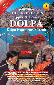
Description
Title:UPPER & LOWER DOLPO
Subtitle: DOLPA EXPERIENCE CIRCUIT
Area: Dolpo Region
Scale: 1:125, 000
Longitude: 82° 00′ – 83° 12′
Latitude: 28° 51′ – 29° 37′
Altitude Range: 2700m – 5400m
Difficulty: Very Strenous
Days: 20 – 22
Organization: Organized
Route: JOMOSOM, SANGDAK, NIWAR PASS, CHHARKA BHOT, TINGE GAON, SHIMENGAON, SALDANG, SHEY GOMPA, PHOKSUNDO, PHOKSUMDO LAKE, JUPHAL, DUNAI, LINGDO, LAISICAP, NAWARPANI, DHO, NUMLA, BAGALA PASS, RINGMO
Edition: September 2010
ISBN: 99933-23-35-7


Richard Ottvall –
Title:UPPER & LOWER DOLPO
Subtitle: DOLPA EXPERIENCE CIRCUIT
Number of maps: 2
Bohdan Linda –
How can I get map of Lower Dolpo, please? Is it possible to get this map by e-mail?
With kind regards
Bohdan Linda
Glenn Ingram –
I am interested in your map of Upper & Lower Dolpa – the Dolpa Experience Circuit. What would be the cost and how can I get the money to you if this can be mailed to me. Thank you
silvano –
Is the digital Dolpa map available? If yes what is its cost?
Best Regards
Silvano Lonardi
Verona Italy
Alex Statiev –
Hello,
I’d like to get two maps: 1. Upper and Lower Dolpo; 2. Dhaulagiri circuit. Can you please let me know how I can order these two maps?
Thank you
Michael Bligh –
I would like to purchase the most detailed and accurate map you have of Lower & Upper Dolpa
oliver –
very good